Slieve Bloom Kinnitty MTB trails – Offaly
Overview
Welcome to the Slieve Bloom Mountain Bike Trails in Kinnitty, County Offaly. This is a network of purpose-built singletrack trails and forest roads that are designed for use by mountain bikes on a waymarked circular route. There are four routes to choose from, two of which are blue grade, the other two are more challenging red grade options. The trails take riders through beautiful forests and open land with fantastic views over Kinnitty Castle and beyond. Forest road climbs lead to twisty singletrack with lots of fast descents, ups and downs, tight turns and technical rocky bits, guaranteed to leave you smiling! The trails are waymarked in one direction, please follow the directional arrows.
The route uses multiple sections of public road, forest roads and crosses many walking trails. Riders should obey the rules of the road and expect to encounter vehicles and other forest users at any time. In general, the trails are exposed on the upper slopes and can be very windy in poor weather. Please make sure your mountain bike is in good working order and that you have an appropriate level of fitness and skill level to undertake these trails. All riders should be appropriately dressed, use a suitable mountain bike and wear a helmet at all times. Please ride with consideration for other forest users and control your speed.
There are more MTB trails open on the Laois side of Slieve Blooms, centred at Baunreagh. Click here for details Laois trails
The trails are developed in partnership with Offaly and Laois County Councils and are funded by the Dept of Rural and Community Development, with additional funding support from Fáilte Ireland.
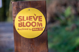
MTB trail images
These will give you a good idea of what it's all about - lots of flow, nothing too mad, very smiley trails!
Visitor Facilities on site
All available in Kinnitty village – parking, toilets, café and accommodation along with lively entertainment in the two village pubs.
Kinnitty Blue Route
Kinnitty Blue – Trail Description
Leaving Kinnitty Village the route follows the public road, caution with other road users is needed. Turning right into Kinnitty GAA club, pick up the wide ‘dual direction’ trail which leads to ‘The Hub’, a key point on your journey in the Slieve Bloom Mountain Bike Trials. Caution, beware of cyclists approaching in the opposite direction on the dual direction trail.
The route climbs uphill from ‘The Hub’ on the ‘Bluebell’ trail all the way to ‘Waypoint 1’ where riders should bear right, following the blue directional arrows. Trail highlights include ‘Cool Runnings’, ‘Rock & Roll’ and ‘The Full Hog’. The full distance of the Kinnitty Blue route is 9km but there is an optional shortcut which reduces the distance.
Trail Grading
This blue grade trail is graded moderate, with numerous difficult sections along the route. The trails vary from fast and flowing to tight and technical. Sometimes steep and narrow, with variable surfaces including rock, roots, mud, loose stones and gravel that may become slippery when wet. This trail is for proficient cyclists only.
Information
Route Name: Kinnitty Blue
Start/Finish Point: Kinnitty village
Distance: 9km with 220 meters climbing
Time: 45 minutes to 110 minutes
Degree of Difficulty: moderate to difficult
Trail Waymarking: Blue circle
River Run Route
River Run Route
This 23km red grade route shares the same outward leg as the Kinnitty Blue route, climbing all the way from Kinnitty Village, through ‘The Hub’ and past ‘Waypoint 1’. Follow the red directional arrows to the next junction until you arrive at ‘Waypoint 2’, a key point on your journey at the Slieve Bloom Mountain Bike Trails. Once here, there are two red grade routes to choose from, ‘Mountain Top’ to the left or ‘River Run’ to the right.
The River Run route starts off with a climbing singletrack trail called ‘The Yellow Brick Road’, followed immediately by one of the highlights along the River Run route, the ‘ASAP’ trail, a fast flowing rocky descent which takes you to the public road at ‘The Blue Gates Upper’. Exercise caution crossing the public road and yield to motorists and road cyclists at this point. Next up is ‘The Cobbler’ trail, a meandering route that weaves through the Connor’s homestead, switch back climbs weave up through the most spectacular mature pine trees before plummeting down to meet the Camcor river.
The ‘Valley Run’ trail meanders across the Stillbrook Hill into the next valley where the main descending section of River Run route begins. ‘Secret Squirrel’, ‘Yeti’ and ‘Last Chance’ are the three main trails, each with their own unique flavour dropping you down to the Camcor river once again. Exercise caution crossing back over the public road at ‘The Blue Gates South’ and prepare yourself for the final climb of the River Run route. Follow the forest road to ‘Waypoint 4’, here you can take a shout cut back by joining the blue grade ‘Cool Runnings’ trail on the Kinnitty Blue route or continue uphill on the River Run red grade route. The effort to climb the final hill is well rewarded with a spectacular 4km long descent named ‘Space Jam’, which takes riders all the way back to the trailhead at Kinnitty Village.
Trail Grading
This red grade route is difficult throughout with numerous severe sections along the route. The trails vary from fast and flowing to tight and technical. Frequently steep and narrow, with variable surfaces including rock, roots, mud, loose stones and gravel that may become slippery when wet. This trail is not for novice mountain bike riders.
Information
Route Name: River Run
Start/Finish Point: Kinnitty Village
Distance: 23km with 490 meters climbing
Time: 110 minutes to 180 minutes
Degree of Difficulty: Difficult to severe
Trail Waymarking: Red circle
Mountain Top Route
This 31km red grade route shares the same outward leg as the Kinnitty Blue route, climbing all the way from Kinnitty Village, through ‘The Hub’ and past ‘Waypoint 1’. Follow the red directional arrows to the next junction until you arrive at ‘Waypoint 2’, a key point on your journey at the Slieve Bloom Mountain Bike Trails. Once here, there are two red grade routes to choose from, ‘Mountain Top’ to the left or ‘River Run’ to the right.
There are some amazing singletrack descents on the Mountain Top route starting with ‘Twist & Shout’, a beautiful flow trail with over 40 berms and zero pedalling! A short forest road climb brings you to ‘Road Runner’, a highspeed swoopy trail which descends to the historic Lime Kiln. Exercise caution as you cross the public road at ‘The Lime Kiln North’ and yield to motorists and road cyclists at this point. Next up is the ‘Mitchells’ trail, a meandering route that skirts the Mitchell’s family homestead, across the old bridge and down to the forest road to meet ‘Waypoint 3’.
Here riders can continue straight ahead and stay on the Mountain Top route, or bear left and cross over to the Laois side of the Slieve Bloom Mountain Bike Trails via the red grade ‘Crystal Maze’ trail. Note that joining the Laois trail network is a long distance route and should only be undertaken if you are a highly experienced and highly competent mountain bike rider.
Next along the Mountain Top route is ‘Flintstones’ a short and snappy feature rich descent with plenty of fun to be had. After a short forest road climb you will be rewarded with some of the most iconic descents in the Slieve Bloom Mountain Bike Trail network, ‘Donkey Kong’ which connects straight into ‘Nature Valley’. The Mountain Top route merges into the River Run route for the return trip all the way back to the trailhead at Kinnitty Village.
Trail Grading
This red grade route is difficult throughout with numerous severe sections along the route. The trails vary from fast and flowing to tight and technical. Frequently steep and narrow, with variable surfaces including rock, roots, mud, loose stones and gravel that may become slippery when wet. This trail is not for novice mountain bike riders.
Information
Route Name: Mountain Top
Start/Finish Point: Kinnitty Village
Distance: 31km with 570 meters climbing
Time: 150 minutes to 230 minutes
Degree of Difficulty: Difficult to severe
Trail Waymarking: Red Asterix
Kinnitty Village
Welcome to the Kinnitty Village Mountain Bike Trail, County Offaly. This is a network of purpose-built singletrack trails that are designed for use by mountain bikes on a waymarked circular route. There are three blue grade trails to choose from, each waymarked from this central start point. The trails take riders through beautiful forests on twisty singletrack with lots of fast descents, ups and downs, guaranteed to leave you smiling! The trails are waymarked in one direction, please follow the directional arrows.
The route uses multiple sections of public road, forest roads and crosses many walking trails. Riders should obey the rules of the road and expect to encounter vehicles and other forest users at any time. Please make sure your mountain bike is in good working order and that you have an appropriate level of fitness and skill level to undertake these trails. All riders should be appropriately dressed, use a suitable mountain bike and wear a helmet at all times. Please ride with consideration for other forest users and control your speed.
BLUE ROUTE
This blue grade trail is graded moderate, with numerous difficult sections along the route. The trails vary from fast and flowing to tight and technical. Sometimes steep and narrow, with variable surfaces including rock, roots, mud, loose stones and gravel that may become slippery when wet. This trail is for proficient cyclists only.
Information
Trails: Easy Peeler, Mint Crisp, Banana Split
Distance: 2km with 50 meters climbing
Time: 10 to 20 minutes
Degree of Difficulty: Moderate to difficult
Trail Waymarking: Blue circle